articlevc
www.77vcd.com 时间:2021-02-12 阅读:()
DESIGNANDDEVELOPMENTOFAUTOMATICNAVIGATIONSOFTWAREFORFARMINGMACHINES1,GangLiu,*11AgriculturalUniversity*Abstract:Thenavigationsoftwareplayedanimportroleincontrolling-decisionforAutomaticNavigationsystem.
Itmainlycompleteddatareading,dataprocessinganddataoutputting.
Thedatareadingmoduleaccepteddatefromdifferentsensorsviaserialportsandextractedusefulinformation.
Thedataprocessingmoduleincludedimprovingpositioningaccuracyandcalculatingthevalueofcontrolparameter.
Thedataoutputtingmoduleshowedthenavigationstatusforusers.
Thesoftwareranwellinpractice.
Keywords:1.
INTRODUCTIONAutomaticnavigationsystemwasthebaseofprecisionfarming.
Theycouldarriveatcorrectpositionbytrackingpredefinedpathtocompletedatacollectingandseeding.
Thoughthestudyofautomaticnavigationsystemforagriculturehadalonghistory,itisatthestartingstageinChina(Q.
ZhangandH.
Qiu,2004).
Thispaperfocusedontheresearchofnavigationcontroltechniqueandpositioningmethodwhichwereimplementedinthesoftware.
automaticnavigation,mapmatching,fuzzylogiccontrol,multi-threadsYang,Y.
andLiu,G.
,2008,inIFIPInternationalFederationforInformationProcessing,Volume259;ComputerandComputingTechnologiesinAgriculture,Vol.
2;DaoliangLi;(Boston:Springer),pp.
1345–1348.
YunuoYangChina,Tel:86-10-62736741,Fax:86-10-62736746,Email:pac@cau.
edu.
cnKeyLaboratoryofModernPrecisionAgricultureSystemIntegrationResearchChinaCorrespondingauthor,Address:P.
O.
Box125,QinghuaDonglu17,Beijing,100083,P.
R.
Theprimarygoalofthisarticlewastoexploreagoodpositioningalgorithmandcontrolmethodandtodevelopaneffectivesoftwaresystemforimprovingaccuracyandstabilityofnavigationsystem.
2.
DESCRIPTIONOFAUTOMATICNAVIGATIONSYSTEMThesystemwasconstitutedbythreeparts:amaincomputer,anassistedcomputerandafarmingvehicle.
ThenavigationsoftwarerunningonthemaincomputeracceptedGPSdatafromGPSreceiverandpostureinformationfromtheassistedcomputerviaserialports.
Basedonthisdata,moreaccuratepositioncoordinatesandcontroldecisionvalueswouldbeachieved.
Thenthemaincomputercommunicatedwiththeassistedcomputertoguidethevehicle.
vehicle'speedandsteeringangle.
Theassistedcomputerreadsignalsfromsensorsandsentthemtothemaincomputer.
Itgotthedesiredsteeringangleandsentittothesteeringcontrollerwhichcoulddrivethevehicle.
3.
PRINCIPLESANDMETHODS3.
1NavigationpositioningalgorithmGPScouldaccuratelymeasuretheabsolutepositionoffarmingmachineinthefield,butitmighthaveerrorscausedbythecomplexenvironmentalconditions.
ThoughDead-reckoning(DR)algorithmcouldcalculatetherelativepositionbasedoninformationfromsensors,errorswouldbeaccumulatedduringalongtime.
ThisresearchputforwardMap-Matching(MM)theorytoimprovetheabovemethods.
Fuzzylogictheorywasdiscussedtocalculatetheirweightsaccordingtothedesiredpathinformationpositionaccuracyinpractice.
thedigitalcompasswasusedtoevaluatetheorientationofthevehicle.
TheDifferentposturesensorswereusedtogetmoreefficientinformation.
velocitysensorandanglesensorwasdesignedtodetecttravelingtheYunuoYang,GangLiuToshowthenavigationinformation,thesoftwareprovidedafriendlyinterfaceonwhichuserscoulddetecttheposition,speedanddirectionetc.
offarmingmachine.
Alltheinformationcouldbesavedforfurtheranalysis.
1346(H.
W.
Griepentrogetal.
,2006).
Themethodwashelpfulforimprovingthe3.
2NavigationcontroltechniqueThekeytechniquesofthispartweresearchingdynamicpathanddecidingcontrolvolume.
Adynamicpathsearchwasamethodtodeterminethenexttargetpointbasedonboththepathcurvatureandthevehiclespeed(ZhouZhiyan,2005).
Thepathlook-aheaddistancedeterminedbyfuzzylogictheorywasthelengthoftheprospectivepathandwasusedtolocatethepropertargetonthepath.
Thetargetpointwasusedtoevaluatethelateraldeviationandyawangle.
Thesedatawereusedtodeterminethedesiredsteeringangletoguidethevehicleaccuratelyalongthepredefinedpath.
4.
DESIGNANDDEVELOPMENTOFSOFTWARESYSTEM4.
1DesignofsoftwaresystemstructureToensureareal-timeperformance,thesystemappliedthemulti-threadsmethodondemandofmulti-tasks.
Asthethebodyofsystem,themainthreadaccomplisheddisplayingtrackingposition,operatingmap,MMmethodanddeterminingdesiredsteeringangle.
Italsowouldcommunicatewiththesemodulesandco-operatedwiththeassistedthreads.
Theassistedthreadswerepathdesigningandcommunication.
Theformeronedesignedtheoptimumpathbasedonthedatabasefollowingsomeprinciples,andthelateronecommunicatedwiththeassistedcomputertoacceptinformationandsendsignaltoeachother.
4.
2DevelopmentofsoftwaresystemThesystemwascomposedoffourmodulesillustratedbythefollowingstructure.
Thedatacommunicationmodulemainlysetportparameters,receivedsignalsfromdifferentsensorsandsentdecisioncommandtotheassistedcomputer.
Theimplementationofthisisapplicableappliedforwasapprovedhavinghigh-efficiency.
Themapmoduleincludedmapmaking,mapoperatingandmapdisplaying.
TogetanaccuratemapthisresearchfirstlygotCADmap,thenconvertedittoashapemapbyArcview3.
2systemandcollected7basepointsbyGPSreceivertoadjustmap.
Themapoperatingincludingzoomingout,zoominginandpanningwasdevelopedbyGISActiveXMapObjects2.
2.
Pathtrackinganddisplayingwasalsodesignedinthismodule.
ThepathdesigningmodulecoulddeterminethepointsattheendofthefieldandsetaproperbufferfortheCSerialPortclasstocontrolthreeports(GongJianwei,2005).
ThemethodDesignandDevelopmentofAutomaticNavigationSoftware1347farmingmachineturning.
Theprinciplesweredifferentbasedondifferentfieldshapes,vehiclestructuresandfarmersneeds.
Dijkstraalgorithmwasadoptedtofulfillpathplanningaccordingtoseveraloptimumprinciples.
AsthemostimportantpartthenavigationcontrollingmodulewasconstitutedofMM,calculatingpreviewpointanddeterminingdesiredsteeringangle.
Thesemoduleswereassociatedwiththenavigationgeographicdatabasecontainingmapinformationandmovingvehicleinformation.
MicrosoftAccess2003databasewasusedtosavedataandShapefilesmethodwasadoptedtomanagedata(LiuGuangandLiuXiaodong,2004).
5.
CONCLUSIONSomevalidationtestswereperformedontheplaygroundintheeastcampusofChinaAgriculturalUniversity.
Accordingtotheresults,thesoftwarecouldrunwellandthenavigationsystemcouldresponseintime.
ACKNOWLEDGEMENTSThispaperissupportedbythenational863projects:ControlTechniqueandProductDevelopmentofIntelligentNavigationofFarmingMachines(2006AA10A304).
REFERENCESZhouZhiyan,StudyontheNavigationGeographicInformationSystemfortheIntelligentGongJianwei,VisualC++/TurboCSerialPortsCommunication,PublishingHouseofElectronicsIndustry,2005.
LiuGuangandLiuXiaodong,GISDevelopment—VC.
NETandMapObjects,TsinghuaUniversityPress,2004.
MechatronicsandApplications,2006.
FarmingChassis,SouthChinaAgriculturalUniversity,2005.
YunuoYang,GangLiu1348Q.
ZhangandH.
Qiu,ADynamicPathSearchAlgorithmforTractorAutomaticNavigation[J].
AmericanSocietyofAgriculturalEngineers,2004,47(2):639-646.
H.
W.
GriepentrogandB.
S.
Blackmore,PositioningandNavigation,pp.
195-204ofChapter4
- articlevc相关文档
- basalwww
- Selectvc
- 交易员应用程序
- www.77vcd.com谁能告诉我一个免费看电影的网站啊?
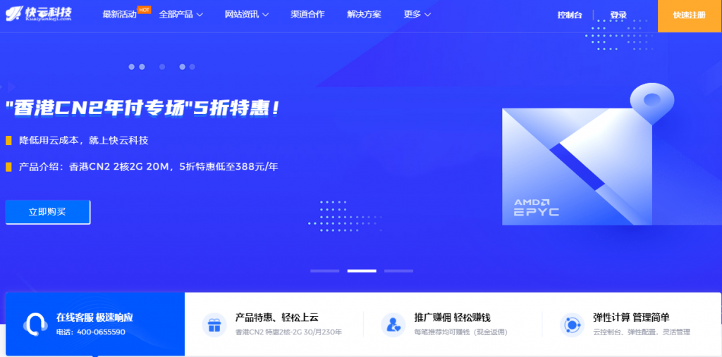
香港云服务器 1核 1G 29元/月 快云科技
快云科技: 12.12特惠推出全场VPS 7折购 续费同价 年付仅不到五折公司介绍:快云科技是成立于2020年的新进主机商,持有IDC/ICP等证件资质齐全主营产品有:香港弹性云服务器,美国vps和日本vps,香港物理机,国内高防物理机以及美国日本高防物理机产品特色:全配置均20M带宽,架构采用KVM虚拟化技术,全盘SSD硬盘,RAID10阵列, 国内回程三网CN2 GIA,平均延迟50ms以下。...
legionbox:美国、德国和瑞士独立服务器,E5/16GB/1Gbps月流量10TB起/$69/月起
legionbox怎么样?legionbox是一家来自于澳大利亚的主机销售商,成立时间在2014年,属于比较老牌商家。主要提供VPS和独立服务器产品,数据中心包括美国洛杉矶、瑞士、德国和俄罗斯。其中VPS采用KVM和Xen架构虚拟技术,硬盘分机械硬盘和固态硬盘,系统支持Windows。当前商家有几款大硬盘的独立服务器,可选美国、德国和瑞士机房,有兴趣的可以看一下,付款方式有PAYPAL、BTC等。...

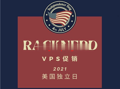
racknerd新上架“洛杉矶”VPS$29/年,3.8G内存/3核/58gSSD/5T流量
racknerd发表了2021年美国独立日的促销费用便宜的vps,两种便宜的美国vps位于洛杉矶multacom室,访问了1Gbps的带宽,采用了solusvm管理,硬盘是SSDraid10...近两年来,racknerd的声誉不断积累,服务器的稳定性和售后服务。官方网站:https://www.racknerd.com多种加密数字货币、信用卡、PayPal、支付宝、银联、webmoney,可以付...
www.77vcd.com为你推荐
-
商标注册流程及费用我想注册商标一般需要什么流程和费用?西部妈妈网加入新疆妈妈网如何通过验证?www.zjs.com.cn请问宅急送客服电话号码是多少?www.mywife.ccMywife-No 00357 MANAMI SAITO种子下载地址有么?求好心人给ip查询器查看自己IP的指令广告法广告法有什么字不能用www.hyyan.comDOTA6.51新手选什么英雄为好,请详细讲述出装备顺序,加点顺序,以及注意事项。谢谢555sss.com不能在线播放了??555www.jsjtxx.com怎样让电脑安全又高速bihaiyinsha碧海银沙中国十大网页?